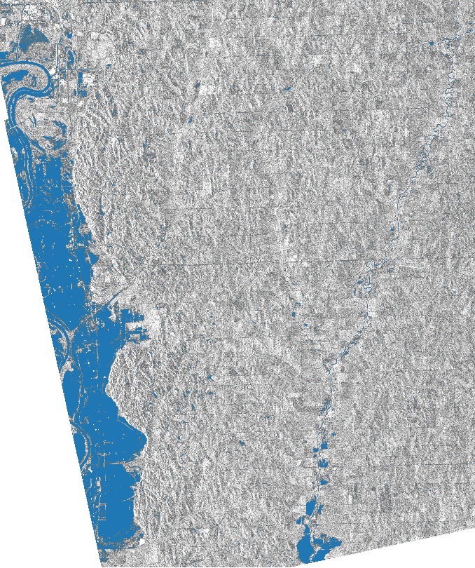
Remote Sensing Perspective of Omaha Flooding
Figure: produced by processing the Sentinel-1 SAR (Synthetic Aperture Radar) data over Omaha city in Nebraska, where the blue colour shows the extent of flooding.
Climate-related disasters have dominate over the past 20 years, according to UNISDR (United Nations International Strategy for Disaster Reduction). 7,255 events were recorded between 1998 and 2017 and 91% of them were climate-related disasters. Floods were the most frequent type of disaster, accounting for 43% of all recorded events.
Damages caused by natural calamities are globally putting an immense amount of pressure on economy. Floods are one of the most destructive natural disasters both in terms of casualties and economic loss. Globally the floods are increasingly being caused by climate change, extreme rain falls and human alteration to land surface hydrological cycle. Only in March 2018, we have seen three major flooding events in United States (Omaha, Nebraska), Iran (Shiraz) and Africa (Mozambique).
Few years back, one of them biggest challenges was to monitor the impact and severity of these types of disasters at large scale and get the full synaptic view. We did not have the resources or technology to perform this task effectively. However, there is a whole lot of technologies in form of multiple space-borne imaging satellites orbiting the Earth. These satellites have\ very short revisit time and fully capable to acquire high resolution near real-time images on daily (Planet Labs - Doves form the largest satellite constellation), weekly (Sentinel-1 & 2 Constellations) and biweekly (Landsat Constellation) basis.
Revolutionary developments in satellite and remote sensing technology has lowered cost of operation very significantly. On top of that, the open data policy has opened up a new "golden era" of remote sensing and geospatial applications. Organizations have started to leverage the satellite for development of operational risk and disaster monitoring systems and solutions.

